| Most viewed - User galleries |
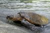
Honu’ea2682 viewsTaken 4/7/06
Honu’ea or Hawksbill Turtle is native to Hawai’i. The species is considered to be endangered but is slowly growing thanks to conservation efforts particularly on the Big Island of Hawai’i where they are protected by law. The Hawksbill can grow up to 250 pounds and feeds mostly on green sea moss or sponges. Their nesting period runs from July to October. Building the nest and laying eggs takes several hours and they can easily be seen along the coast.
|
|
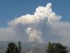
Pyrocumulus2682 viewsWhile I'm not sure this word exists in a Dictionary, it is used commonly used when talking about fires or volcanic eruptions. It is caused by the hot air and smoke combining with the moisture which induces a convection which carries the smoke and ash up to altitudes of 20,000 feet or more.
|
|

Peek-A-Boo Sunrise2681 viewsThe Sun peeks through in between the horizon and the clouds above. Taken 11/10/06 at Punta Estrella, just South of San Felipe.
|
|
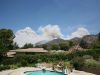
Paradise Lost2680 viewsThe normal calm and tropical atmosphere of my backyard is upset by the Station Fire seen here overtaking Brown Mountain.
|
|

Altadena Sunset2672 viewsThis was taken 12/11/05 at about 2000 ft elev from a street above my house. Moist air made its way up into Southern California from the Gulf Of Mexico bringing with it some interesting weather and beautiful Sunsets. Taken with my Canon Digital Rebel and a 75-300mm Zoom Lens.
|
|

Me And My Shadow2671 viewsWe took off to the South and then turned West. As we banked in the turn, over the Los Feliz area I believe, you could see our shadow on the ground below.
|
|
2671 views
|
|
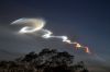
Minotaur 52671 views"Aftermath" September 22, 2005 marked the first Vandenberg AFB dusk launch in nearly three years. The Minotaur booster Lifted off from south Vandenberg just after 19:24 PDT, the start of a 16-minute launch window.
This last photo shows the remainder of the vapor trail several minutes following the launch. The upper atmosphere winds have twisted it. Taken from the Pasadena area using my Canon Digital Rebel.
|
|
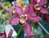
2671 viewsPurple Orchid Taken at the Pasadena Farmers Market.
|
|
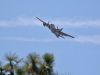
Neptune2670 viewsThe Lockheed P-2 Neptune was originally Naval Patrol Bomber used for Anti-Submarine warfare. Converted into an aerial tanker, it can carry 2,700 Gallons of Fire Retardant.
|
|

Look Out !2670 viewsTaken 4/6/06
While driving along the Saddle Road that goes between Mauna Kea and Mauna Loa, my Brother and I encountered this warning sign. We had read about the Military Base located in the area and the possibility of encountering Military Vehicles or Aircraft, but seeing this sign added a little excitement to the trip.
|
|

Heading For Port2670 viewsOne of the Tall Ships heading back into port. Tall Ships Festival Oxnard CA.
|
|
| 348 files on 29 page(s) |
 |
|
|
|
|
|
|
16 | |
|
|
|
|
|